The Forest Ownership Centre
Finca Torreferrussa
Ctra. B-140, Sabadell a Santa Perpétua de Mogoda, km 4,5
08130 Santa Perpètua de Mogoda (Barcelona)
Phone: 935 747 039 – Fax: 935 743 853
E-mail: info@lifeclimark.eu
Scope of action:

UP Vall de Rialb
UP El Montmell
UP Aspres
UP Replans de Berguedà
UP Capçaleres del Llobregat
UP Serres d’Ancosa
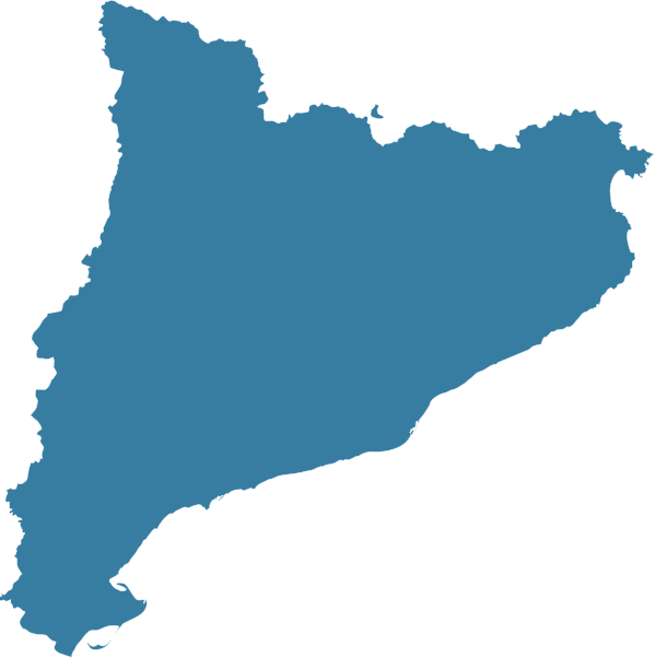
The project focuses on six landscape units (UP) contrasted and represented in Catalonia, in addition to two in Italy, where the demonstration stands will be established..
The visible structure of this unit comprises the depression of the Rialb drainage basin, which is covered by extensive, continuous vegetation. The northern part of the unit is a dense mountainous structure, mostly situated between the altitudes of 500 and 1,000 m, with an average slope of close to 30%.
This area is clearly forest, with few limitations for tree growth. The green of the pines is notable and the forest forms an almost continuous mantle interrupted only by the rocks that, in certain places, are very compact and form scarps. The main land use in the area is forestry, but this is not intensive and has slowed considerably.
The Montmell range dominates the scenery and is the most characteristic element of the landscape. It comprises a group of mountain ranges and harsh limestone hills that ascend in altitude diagonally, from the southwest to the central part of the Unit, culminating in the north with the Talaia peak, at 861 m. The slopes are predominantly covered by shrubby vegetation and pine woodland, which together account for 89% of the total surface area within the Unit.
The Aspres Unit includes a particularly extensive expanse of spontaneous vegetation, which covers 72% of its surface area. Within this zone, we should distinguish between the area corresponding to forest (32%) and that attributed to shrubland and meadows (38%).
To the west of the Llobregat river there is a fairly overwhelming domain of sclerophyllous forest, specifically cork oaks or mixed cork and holm oak forests. The undergrowth includes plants typical of holm oak forests, together with heliophytes that are able to grow thanks to the relatively light-rich environment afforded by the sparse canopies of the dominant trees.
In the Replans de Berguedà area the landscape consists of the intersection of steep relief formations to the north and minor sierras and terraced hills with gentle slopes to the south, forming an agroforestry mosaic mainly made up of pine trees, scrub, pastures and cereal crops.
Action will be taken in a 15 ha area on stands in post-fire regeneration and adult stands (P. sylvestris).
The landscape of the Capçaleres del Llobregat stands out for its eminently mountainous and abrupt character, with significant limestone relief, in addition to the predominance of forest cover. The characteristic silhouette of the Pedraforca massif characterises this Unit.
69.2% is covered by forests, the result of the large number of mountains and ranges comprising it. Almost all the Catalan forest types are represented through its altitudinal evolution.
The Sierras de Ancosa are mainly characterised by low and medium-height mountain ranges oriented from the southwest to northeast. Shrubland, scrub and forest predominate, in addition to fields in the flatter areas.
The vegetation occupies a large part of the territory, some 71.55%. The majority of this is composed of Aleppo pine woodland, secondary forests that have taken over from holm oaks and sessile oaks, and which, generally, cover the slopes.
Landscapes units:

CANSIGLIO
LORENZAGO DI CADORE
Landscapes units (LUs) included in the project
Regió del VENETO
The area is located in the Region of Veneto, in Province of Belluno (at the border with the Province of Treviso). It is included in the Natural Biogenetic Reserve “Pian Parrocchia-Campo di Mezzo” (established in 1977).
The forest, with beech (Fagus sylvatica) as dominant species, covers an area of 667 ha, totally included in Special Protection Zones (ZPS, 79/409/CEE) and in Sites of Community Importance (SIC, 92/43/CEE). Since 1996, the forest hosts also a site of the Italian network of the forest ecosystem monitoring (CONECOFOR), part of the of the UN/ECE International Cooperative Programme of Forests (ICP Forests, http://www.icpforest.org) that, in 2009- 2010, was monitored under LIFE+ FutMon (http://www. futmon.org).
The forest has a long tradition of forest management: the basic rules applied are moderate thinning from below or mixed thinning, repeated every 20 years, while stand regeneration is by group shelterwood system. Generally, an amount of 700-1000 m3 of wood is extracted per intervention, over 10 to 15 ha. The forest management is carried out by the Ufficio Territoriale Carabinieri per la Biodiversità (UTCB) of Vittorio Veneto.
The Experimental area selected for LIFE+ CLIMARK lies in a beech high forest compartment aged 120 to 145 years, at an altitude ranging from 1100 m to 1200 m a.s.l.. Currently, the age of final cutting is being shifted to a not-definite (at now) stand age, to match the emerging recreational, landscape and climate change mitigation functions. Site parameters (elevation, position, soil, rainfall amount and pattern) are optimal for beech growth and such conditions allow the prolongation of standing crop permanence time (rotation length).
An area of 35 hectares, divided into nine (plus one) compartments, was devoted to the management trials of LIFE + ManFor C.BD. (www.manfor.eu). Three options were identified and randomly assigned in three replicates to the compartments (1 to 9). A cluster of three permanent circular sampling plots was established within each compartment according to a systematic design to survey measuring parameters (species, dbh, height, tree position, social rank, crown projections, etc.).
The three management options proposed for the Cansiglio site were:
An additional area (not replicated) has been set-up as the first-ever implemented ‘ageing patch’ (literally from French ‘îlot de sénescence’). It consists of an area of a few hectares (2-3 ha) where trees are left to an indefinite ageing up to their death and decay; where holes on standing trees and snags are being created, where a part of living stems are partially cut along outer circumference up to cambium to make them becoming dead standing trees or felled and left on the ground to establish micro-habitats, niches and corridors for insects and micro-fauna.
Els boscos del municipi de Lorenzago di Cadore, a la regió del Vèneto, província de Belluno, cobreixen una àrea total de 1.100 ha i es caracteritzen per combinar pícea, avet, faig i làrix (Picea abies, Abies alba, Fagus sylvatica, Larix decidua). La zona de Lorenzago di Cadore forma part d’una de les zones de protecció especial més extenses dels Alps (ZPE IT3230089 «Dolomites de Cadore i Comelico») i conté dos llocs d’importància comunitària (LIC, 92/43/CEE). Els boscos de Lorenzago han obtingut el certificat PEFC per la gestió forestal sostenible.
El lloc seleccionat en el projecte LIFE+ ManFor C.BD. es troba en un bosc mixt de coníferes (avet blanc, 51 %; avet roig, 46 %; làrix europeu, 2 %; faig, 1 %) d’edats diferents, situat entre 925 i 1.220 m per sobre del nivell del mar i gestionat tradicionalment mitjançant el sistema de selecció.
Els assaigs de gestió forestal es van dur a terme a 25 hectàrees i es van aplicar dues opcions de gestió diferents, que s’exposen a continuació:
Al lloc es van crear 6 parcel·les de mostratge permanent (amb un radi de 30 m) per representar la variabilitat del bosc i els tractaments.